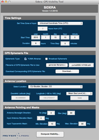
Main Features:
-
• Time
-
-specify the observation time start and duration, as well as time increment
-
• GPS Ephemeris File
-
-options to select which almanac and ephmeris files to utilize during visbility computations
-
-download these files when connected to Internet
-
• Antenna Location
-
-specific the precise location of the antenna
-
-multiple locations can be stored in file and selected from pull-down menu
-
• Antenna Pointing and Masks
-
-set the antenna boresight direction
-
-define the elevation mask angles on the antenna
-
• Outputs
-
-numerous plots are provided that describe the visibility at the defined location.
-
-computed visibility data can be exported for external use.